



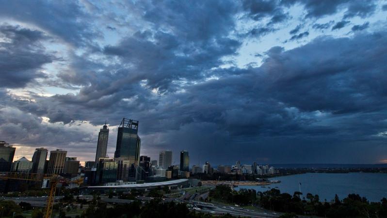
A severe thunderstorm warning has been issued for parts of WA as lightning and hail continue to batter the State.
The Bureau of Meteorology issued the urgent warning for the Goldfields, South East Coastal, and Eucla regions at 12.40pm on Monday.
“Severe thunderstorms have developed along a surface trough in a moist and unstable environment,” the warning read.
“The storms are expected to move towards the south east through the afternoon and evening.
“Severe thunderstorms are likely to produce damaging winds, large hailstones and heavy rainfall that may lead to flash flooding in the warning area over the next several hours.”
Senior Bureau meteorologist Jessica Lingard told PerthNow it was the exact system that had caused havoc in the regions over the weekend.
“It is the same system that caused storms, hail and heavy rainfall on Saturday and Sunday,” she revealed.
“The system is slowly clearing and moving easterly, and by Wednesday afternoon it will have crossed the border into South Australia.”
The front caused an especially hazardous weekend for the Goldfields, who received a staggering 48mm of rainfall on Sunday with a shocking 1.38 million lightning strikes recorded in the area within 48 hours.
Ms Lingard said while the figures seem high, they were not concerning for a storm of this scale.
“It’s not an abnormal amount of lightning considering the size and breadth of this low pressure trough,” she said.
As those in the State’s east prepare for storms, those in the metropolitan area are also being urged to ready their umbrellas.
An onshore flow will bring stop-start showers to those living between Geraldton and Albany from Monday evening, with Ms Lingard forecasting that those in the city and the South West will bear the worst of the system.
“Rains will continue through tomorrow, but they will mainly impact the metropolitan and South West regions of the State,” she said.
“A weak cold front will cross WA on Wednesday, which will also bring some showers to Perth.”
13mm of rain is forecast for Perth over the next three days, with Wednesday set to be the wettest, with up to 5mm of showers.
The mercury will also remain low for Perth’s metropolitan area through the week, with Tuesday’s maximum temperature of 20C making it the coldest Australian city that day.
A marine wind warning has separately been issued for the State’s south on Tuesday, with those living near the Albany coastlines being told to anticipate strong winds between 48 and 61km/hr.
As the systems move inland towards the Northern Territory and South Australia, spring weather will finally return to Perth by Friday.
The final day of the work week will bring clear skies and a toasty maximum of 23C to the metropolitan area.
PERTH WEATHER FORECAST
- Monday: Showers, 11 – 21C 🌧️
- Tuesday: Shower or two, 11 – 20C ☔
- Wednesday: Showers easing, 12 – 19C 🌦️
- Thursday: Partly cloudy, 9 – 20C ⛅️
- Friday: Sunny, 9 – 23C ☀️
- Saturday: Sunny, 11 – 23C ☀️
- Sunday: Mostly sunny, 12 – 22C 🌤️

